McEwens Beach
At McEwens Beach we measure PM10 which are finer airborne particles invisible to the naked eye.
-
Hourly mean as at
- Good
- Fair
- Poor
- Very poor
- Extremely poor
µg/m3 ** Learn about the Qld Gov air quality categories
The dust measurements shown above use unvalidated data, updated as per the time period indicated above the dial. We voluntarily make available this information as a useful tool for our port communities; however, it’s important to remember that the dust measurements shown may change when validated and should not be relied upon as final.
The graphs below show validated data for the most recent calendar year. All dust data shown is provided by a third-party firm, ACOEM, who manage NQBP’s dust monitoring activities at the sites of McEwens Beach, Mackay northern and southern stations. Wind and weather information is provided by Bureau of Meteorology.
Annual 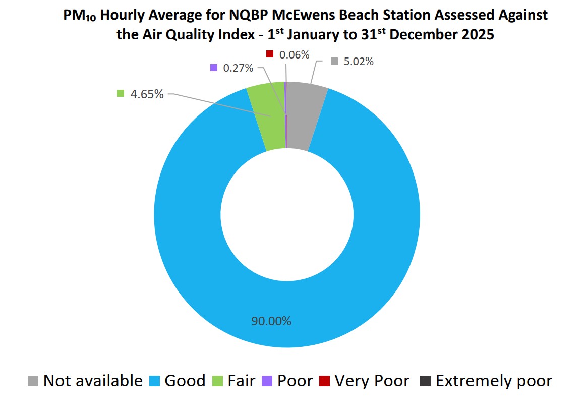 validated data
In 2025, PM10 level of "good" was recorded for 90% of the year at our McEwens Beach site.
Data shown 01/01/202-31/12/2025.
You can also download our hourly validated readings for 2025.
Sites are maintained regularly and periods of time where data is unavailable may reflect these maintenance works.
The McEwens Beach air quality monitoring program began mid-2013.